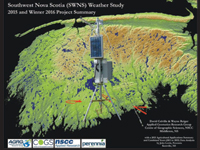
Early in 2011, the three Community Business Development Corporations (CBDCs) of Yarmouth, Shelburne, and Queens/Lunenburg secured funding from more than a dozen sources to launch a project to assess weather conditions and their influence on agriculture potential. Their area of interest was the counties of Digby, Yarmouth, Shelburne, Queens, and Lunenburg. To implement this three-year project (extended to five years in 2014) the CBDCs approached Perennia (formerly Agra Point), for their agricultural consulting experience, and the Applied Geomatics Research Group (AGRG), for their years of experience in similar 'weather mapping' initiatives in the Annapolis Valley. The AGRG took the lead in weather station equipment selection, purchase, deployment, maintenance, data collection and processing. This resulted in the deployment of 42 Onset weather stations to measure both temperature and solar radiation (i.e., sunshine units).
Also in 2011, the AGRG deployed 18 more Onset weather stations (with the same specifications as the other 42) within the Kings and Annapolis counties (as a result of an NSERC ARTI grant). These stations replace previously deployed equipment and complement an additional 14 Campbell Scientific stations that the AGRG has had deployed throughout the Annapolis Valley for almost a decade. These 74 stations allow for coverage of the entire South West Nova Scotia (SWNS) geography, and are the focus of this report. The additional 32 stations do not incur any costs for the CBDC project; however, they are a valuable resource to the project since they allow for an excellent comparison to the weather regimes observed in the agriculturally important Annapolis Valley. Additionally, for all 74 stations the AGRG has collected ground-based, aerial, and satellite imagery which will be very useful for measuring the localized conditions around each weather station. Obstructions such as buildings, trees, etc. can have a definite impact on the temperature and solar radiation recorded at a given site and the AGRG's imagery will allow for a quantification of this impact.


